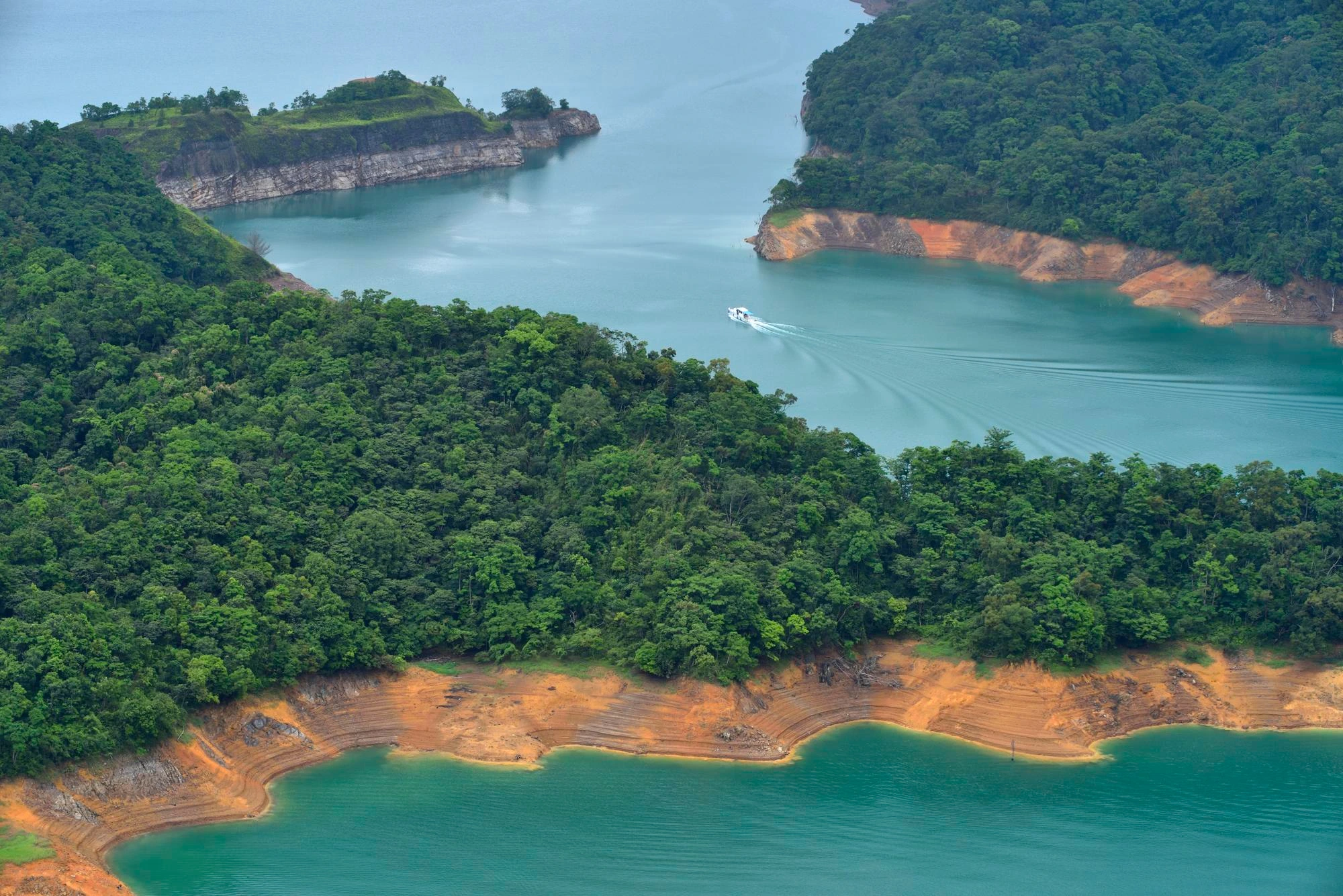
Bangladesh, a country located in South Asia, is often called the “Land of Rivers” and the “largest delta in the world.” The geography of Bangladesh is fascinating—it is shaped by rivers, fertile plains, monsoon rains, and low-lying coastal belts that make it one of the most unique physical landscapes on Earth. For travelers, geographers, students, and researchers, understanding the physical geography and climate of Bangladesh provides deep insight into its culture, agriculture, and lifestyle.
In this detailed guide, you’ll explore the landforms of Bangladesh, the climate of Bangladesh, major rivers, soils, vegetation, and how its physical geography influences everything from agriculture to daily life.
Physical Geography of Bangladesh: Quick Overview
Bangladesh lies between 20°34′ and 26°38′ N latitude and 88°01′ and 92°41′ E longitude, covering about 147,570 sq. km. It is bordered by India on three sides, Myanmar in the southeast, and the Bay of Bengal in the south.
- Physical Features of Bangladesh: Mostly flat plains, fertile delta lands, and some hilly areas in the northeast and southeast.
- Elevation: Most of the country is less than 10 meters above sea level.
- Geographical Features: Floodplains, haor basins, chars (river islands), coastal mangroves, and hill tracts.
- Significance: Bangladesh is one of the most densely populated countries, yet its geography provides fertile soils and abundant water resources.
Major Landforms in Bangladesh
The landforms of Bangladesh are dominated by its river systems and delta formation. The country is broadly divided into three regions: the Deltaic Plains, the Hill Tracts, and the Uplands.
Deltaic Plains: The Heart of Bangladesh
- Formed by the Ganges (Padma), Brahmaputra (Jamuna), and Meghna rivers, this is the most fertile and extensive area.
- These plains are highly productive, growing rice, jute, sugarcane, and vegetables.
- Seasonal flooding deposits nutrient-rich silt, but also causes displacement and erosion.
- Chars, or newly formed river islands, emerge and disappear frequently due to silt deposition.
Barind Tract (Northwest Bangladesh)
- Elevated land made of old alluvium soils, less fertile than floodplains.
- Experiences hotter summers and drier conditions.
- Important for crops like wheat, maize, and pulses.
Madhupur Tract (Central Bangladesh)
- Upland plateau covered with Sal forests.
- Known for red soil and undulating landscapes.
- Historically used for hunting and shifting agriculture.
Haor Basin (Northeast Bangladesh)
- Seasonal floodplains, which turn into vast inland seas during the monsoon.
- Rich in fisheries and wetlands biodiversity.
- Key rice-growing region (Boro rice).
Chittagong Hill Tracts (Southeast Bangladesh)
- Hilly region with elevations up to 1,000 meters.
- Populated by indigenous tribes with unique cultural practices.
- Important for bamboo, forestry, and eco-tourism.
Coastal Belt and Sundarbans
- Sundarbans: World’s largest mangrove forest and UNESCO World Heritage Site.
- Protects inland regions from cyclones and storm surges.
- Coastal islands and tidal flats vulnerable to sea level rise.
Rivers of Bangladesh: Lifeline of the Nation
The geography in Bangladesh is inseparable from its rivers. The country has over 700 rivers, shaping its landscape, economy, and culture.
Three Major River Systems
- Padma (Ganges): Enters Bangladesh from India, merges with Jamuna and Meghna.
- Jamuna (Brahmaputra): Known for shifting channels and frequent floods.
- Meghna: A mighty river system flowing into the Bay of Bengal.
Other Important Rivers
- Teesta (NW Bangladesh): Key irrigation source.
- Surma & Kushiyara (NE): Flow through Sylhet, forming haors.
- Karnaphuli (SE): Only river dammed in Bangladesh, generating hydroelectricity at Kaptai.
Role of Rivers
- Agriculture: Provide irrigation and fertile soil.
- Transport: Vital inland water transport routes.
- Energy: Hydroelectricity and fisheries.
- Challenges: Flooding, erosion, displacement.
Climate of Bangladesh: Tropical Monsoon System
General Climate
- Type: Tropical monsoon climate.
- Seasons:
- Summer (Mar–May): Hot and humid, with thunderstorms (Nor’westers).
- Monsoon (Jun–Sep): Heavy rainfall (80% of annual rain).
- Autumn (Oct–Nov): Transition season.
- Winter (Dec–Feb): Cool, dry, foggy in north.
Temperature
- Summer: 30–40°C (86–104°F).
- Winter: 10–20°C (50–68°F).
- Dhaka Average: 26°C annual average.
Rainfall
- Sylhet (NE): Heaviest rainfall, up to 5,000 mm/year.
- NW Barind: Drier, 1,500–2,000 mm/year.
- Coastal areas: High rainfall, cyclone-prone.
Cyclones & Floods
- Bay of Bengal generates frequent cyclones (April–May & Oct–Nov).
- Annual flooding both sustains fertility and threatens lives.
Soils and Vegetation
- Recent Alluvium: Found in floodplains, most fertile.
- Old Alluvium: Found in Barind/Madhupur, less fertile.
- Hill Soils: Found in CHT, suitable for shifting agriculture.
Vegetation Zones:
- Mangrove forests: Sundarbans.
- Sal forests: Madhupur, Gazipur.
- Evergreen/semi-evergreen: CHT, Sylhet.
Geography and Human Life
- Agriculture: Monsoon climate + fertile plains = rice and jute economy.
- Urban Growth: Dhaka and Chattogram developed on floodplains.
- Challenges: Erosion, flooding, salinity, deforestation.
- Opportunities: Eco-tourism, river tourism, sustainable agriculture.
Climate Change and Bangladesh’s Geography
- Rising sea levels threaten 20% of coastal land.
- Salinity intrusion damages farmland in Khulna & Barisal.
- Cyclones intensify due to warmer seas.
- Adaptation measures: cyclone shelters, embankments, raised homes, floating agriculture.
FAQs: Geography & Climate of Bangladesh
Q1. What are the major landforms in Bangladesh?
The major landforms include the deltaic plains, Barind Tract, Madhupur Tract, haor basins, Chittagong Hill Tracts, and coastal Sundarbans.
Q2. What is the climate of Bangladesh?
Bangladesh has a tropical monsoon climate with hot, humid summers, heavy monsoon rains, and mild winters.
Q3. Why is Bangladesh called a deltaic country?
Because it lies at the confluence of the Ganges, Brahmaputra, and Meghna rivers, forming the world’s largest delta.
Q4. What are haors and chars?
Haors are seasonal wetlands in NE Bangladesh, while chars are temporary river islands formed by silt.
Q5. Which region receives the most rainfall in Bangladesh?
Sylhet region in NE Bangladesh receives the highest rainfall, over 4,000 mm annually.
The geography of Bangladesh defines the nation’s identity—its rivers, fertile soils, monsoon climate, and unique landforms support one of the world’s densest populations. From the Sundarbans mangroves to the Sylhet haors and the Chittagong Hill Tracts, Bangladesh is a land shaped by water and climate. For travelers, researchers, and students, exploring these geographical features reveals why Bangladesh is both a land of challenges and opportunities.


WG777login? That’s where it’s at! Made the login easy peasy. Take a gander wg777login
Just trying to get my game on! Hope this pagcorplogin is smooth as butter. Don’t want any hassle when I’m trying to win big. Good luck to all! For easy access I use pagcorplogin.
Hoping my luck turns around on 600betlucky! The site itself looks good, hoping for some wins! Take a look 600betlucky.
Heard about vvjl444login from a buddy. Gave it a shot and surprisingly, it was pretty smooth. Definitely worth checking out. See what all the fuss is about for yourself vvjl444login
Looking to get the Winexch app? The download was quick and painless. The app itself is pretty intuitive too. Makes things a whole lot easier. Grab the winexch app download and let the good times roll!
Slotspkr is the spot for slots! Tons of different games, and they’re always adding new ones. Great bonuses too. Spin to win, check it out at: slotspkr
Royalscasino, eh? The name sounds fancy. I’d recommend checking it out and seeing if it lives up to the hype. Could be my next go to. Take a look: royalscasino
Royalxcasino999… another casino? Well, what’s one more? If you’re on the hunt for a new place to try your luck, might as well give this one a shot. Here’s the link: royalxcasino999